Frayji Design Group, Inc provides a wide range of professional surveying and mapping services. Our office and field surveying staff applies considerable experience and knowledge to meet each project’s unique set of goals and challenges. From boundary surveys, topographic surveys and construction staking, and project layout we cater to projects varying in size from the quarter acre lot to the master planned community in upwards of thousands of acres, our staff is always ready to respond quickly and efficiently to meet the needs and concerns of our clients.
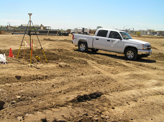
We emphasize communication, excellence and efficiency to meet the needs of each project and client. Knowing that each project is unique, our surveying staff understands that Accuracy and precision above all, is critical in surveying. To ensure the accuracy and precision for your projects, Frayji Design Group utilizes the latest in state-of-the art field surveying equipment and office software combined with the traditional values and conventional techniques of surveying that have been passed down through the generations. Our state of the art equipment includes the most updated versions of Trimble Global Positioning Systems (GPS) Receivers, Servo-Driven total stations, Blue Tooth Survey Controllers with wireless internet connections, Trimble Geomatics Office, AutoCad Land Development Desktop and Civil 3D. Utilizing each of these tools to their maximum capabilities allows us to accurately map any project and enables us to provide our clients with the highest level of confidence and increased productivity that matches and surpasses the industry standards of today. It has always been the number one priority at Frayji Design Group to save our clients both time and money without loosing the personal touch of a family oriented atmosphere.
- Topographic & Boundary Surveys
- Construction Staking
- ALTA /ASCM & Record of Surveys
- Final Maps
- Establish Corner Records
- Boundary Line Adjustments
- Structural Monitoring
- Prepare As-Built Surveys
- Aerial Mapping
- Monumentation
- Geodetic/Control Surveys
- Global Positioning System (GPS)